





Nice Views of Australia Webcams
Watch all of the live HD webcams located on the continent/country of Australia. Australia is world famous for its natural wonders and wide open spaces, its beaches, deserts, “the bush”, and “the Outback”. Webcams in Australia serve as vital tools for various applications, ranging from tourism to environmental monitoring. These devices are strategically placed across the country, capturing real-time images and videos of iconic landscapes, bustling cities, and natural phenomena.
- Live USA Webcams from Various Locations – Explore the Country
- New Caledonia: Explore with Live Webcams
About Austrailia
Australia is a vast and diverse country known for its stunning landscapes, unique wildlife, and vibrant culture. One of the most famous attractions is the Great Barrier Reef, the world’s largest coral reef system. Located off the coast of Queensland, this natural wonder stretches over 2,300 kilometers.
Visitors can enjoy snorkeling, diving, or taking a boat tour to experience the colorful marine life. The reef is home to thousands of species, including fish, turtles, and corals. The breathtaking scenery of the reef and its surroundings draws millions of tourists every year, making it a must-see destination for anyone visiting Australia.
Another iconic attraction is Uluru, a massive sandstone monolith in the heart of the Northern Territory. Also known as Ayers Rock, this sacred site holds great significance for the Indigenous Anangu people.
The stunning sunsets and sunrises at Uluru provide breathtaking views as the rock changes colors depending on the light. Additionally, the surrounding Uluru-Kata Tjuta National Park offers opportunities for hiking and experiencing the unique desert landscape. The combination of natural beauty and cultural heritage makes Uluru a memorable destination for travelers seeking to immerse themselves in Australia’s rich history.
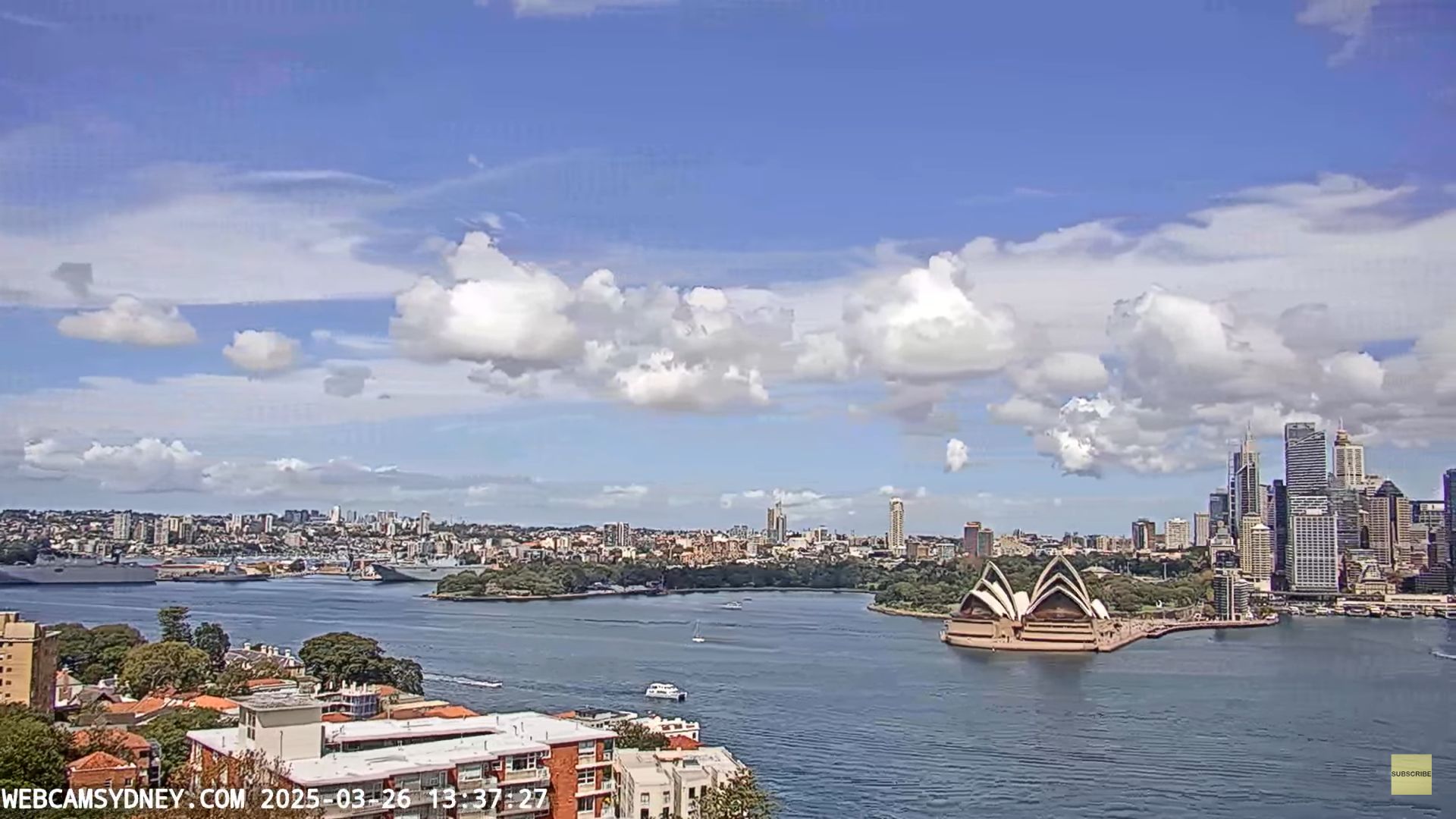
In the coastal city of Sydney, the Sydney Opera House stands out as an architectural marvel. Its distinctive sail-like design has become a symbol of Australia.
Visitors can take guided tours to learn about its fascinating history and see the stunning interior spaces. The Opera House hosts a wide range of performances, including opera, ballet, and concerts, providing entertainment for locals and tourists alike. Nearby, the Sydney Harbour Bridge offers breathtaking views of the city and harbor, with walking paths that allow visitors to admire the scenery from a unique perspective. The combination of cultural experiences and iconic landmarks makes Sydney a vibrant destination for anyone exploring Australia.
Explore the Diverse Landscapes in this country
For those interested in wildlife, a visit to Kangaroo Island is essential. Located off the coast of South Australia, this island is home to remarkable animals, including kangaroos, koalas, and sea lions.
The diverse ecosystems offer opportunities for hiking, birdwatching, and photography in stunning natural settings. Remarkable Rocks and Admiral’s Arch are popular spots for breathtaking coastal views.
Furthermore, the island is known for its conservation efforts, providing a safe haven for many endangered species. Visitors can also indulge in delicious local produce, such as honey and gourmet cheeses. A trip to Kangaroo Island provides a unique opportunity to connect with nature and experience Australia’s incredible wildlife firsthand.
Finally, the Daintree Rainforest, located in Queensland, is one of the oldest rainforests in the world and a UNESCO World Heritage site. This lush, tropical paradise is rich in biodiversity and home to various unique plants and animals. Visitors can explore the forest through walking trails, guided tours, or on a river cruise, where they might spot crocodiles and other wildlife.
The Daintree offers a chance to learn about Aboriginal culture and the importance of conservation. With its stunning scenery, diverse ecosystems, and cultural significance, the Daintree Rainforest provides a captivating experience for anyone looking to explore Australia’s natural beauty and ecological wonders. From coral reefs to ancient rainforests, Australia truly offers an array of attractions that cater to every interest.
Stats & Info
Population: Over 27 million
Race Demographics: English 25.9%, Australian 25.4%, Irish 7.5%, Scottish 6.4%, Italian 3.3%, German 3.2%, Chinese 3.1%, Indian 1.4%, Greek 1.4%, Dutch 1.2%, other 15.8%
Capital: Canberra
Other Major Cities: Sydney, Melbourne, Brisbane, Perth, Adelaide, Gold Coast-Tweed Heads, Canberra-Queanbeyan, Newcastle, Central Coast, Wollongong, Sunshine Coast, Geelong, Townsville, Hobart, Cairns, Toowoomba, Darwin, and Alice Springs
Main Attractions: Sydney Opera House, Great Barrier Reef Marine Park, Uluru-Kata Tjuta National Park, Sydney Harbour Bridge, Blue Mountains National Park, Bondi Beach, Daintree National Park, K’Gari (Fraser Island), Kakadu National Park, Great Ocean Road, Broome, Kangaroo Island, Cradle Mountain-Lake St. Clair National Park, Horizontal Falls
Major Airports: Sydney Airport – IATA Code – SYD
History
The history of Australia is rich and diverse, stretching back thousands of years before European settlement. The ancient Indigenous peoples, known as Aboriginal Australians, have lived on the continent for over 65,000 years. They developed complex societies with deep connections to the land, marked by unique languages, cultures, and traditions.
These communities had intricate knowledge of the environment, including sustainable practices for hunting, fishing, and gathering. Their art and storytelling, often conveyed through cave paintings and oral traditions, reflect a profound connection to their ancestral lands.
This deep-rooted heritage continues to influence modern Australian culture, reminding us of the importance of recognizing and respecting the traditions of its first inhabitants.
In the late 18th century, European exploration began to alter the landscape of Australia dramatically. British Captain James Cook claimed the east coast for Great Britain in 1770, leading to the establishment of the first colony in New South Wales in 1788.
This event marked the beginning of significant changes for Indigenous populations, as settlers brought new technologies, animals, and crops. At the same time, colonization led to land dispossession, the spread of diseases, and violent confrontations, which severely impacted Aboriginal communities.
As more colonies sprang up across the continent, Australia’s demographic and cultural landscape began to shift, as immigrants from various parts of the world arrived, each contributing to the country’s growing diversity.
Throughout the 19th and 20th centuries, Australia continued to evolve, experiencing significant social, economic, and political changes. The discovery of gold in the 1850s triggered a gold rush that attracted many people and helped to shape the economy. The federation of Australian colonies in 1901 marked another important milestone, as Australia became a unified nation with its own constitution.