Real-Time Northern Michigan Marine Traffic, Channel Currents & Harbor Weather
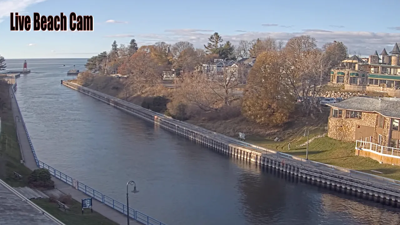
Gain an immediate visual vantage point over one of the most dynamic nautical choke points in the Great Lakes with our live Charlevoix webcam. Streaming in high definition directly from the banks of the Pine River Channel, this live feed captures the vital waterway linking the open waters of Lake Michigan to the protected basins of Round Lake and Lake Charlevoix.
Local captains, recreational boaters, and maritime enthusiasts rely on this page to visually track the historic US-31 drawbridge operations, analyze volatile lake-to-lake currents, monitor channel boat congestion, or check the breaking wave heights along the South Pierhead light before making a run out into the open lake.
Essential Maritime Highlights Near Downtown Charlevoix
CHARLEVOIX WEATHERThe Pine River Channel is the central heartbeat of Charlevoix’s waterfront culture, anchoring several historic and recreational landmarks right on the edge of the harbor:
- The US-31 Drawbridge: A historic bascule bridge that opens regularly on the hour and half-hour during the summer boating season, creating a spectacular parade of classic wooden boats, modern mega-yachts, and commercial vessels.
- Charlevoix South Pierhead Light: The iconic, red-painted steel structure marking the outer entrance of the channel, serving as a premier destination for sunset watchers and wave photographers.
- Earl Young Mushroom Houses: A collection of world-famous stone cottages boasting undulating cedar-shake roofs and organic boulder masonry, tucked quietly into the residential streets just blocks from the north channel bank.
- The Beaver Island Ferry Dock: Located within the immediate Round Lake harbor basin, serving as the year-round departure gate for the Emerald Isle and Beaver Islander passenger vessels.
Charlevoix Harbor & Channel Navigation Map
Coordinate Bridge Crossings, Waterfront Parking & Boat Access
Streamline your arrival in Northern Michigan by utilizing our interactive area map of the Charlevoix waterfront. The Pine River Channel splits the city into distinct north and south sides, meaning that timing your travels around the US-31 bridge lifts is critical to avoiding gridlock along the highway corridor.
Use this custom map layout to pinpoint public vehicle parking options near East Park, find pedestrian access paths to Michigan Beach, or map your boating route through the critical transitional channels of Round Lake.
The Charlevoix live webcam is positioned at the Pine River Channel (45.3183° N, 85.2633° W) in Michigan, connecting Lake Michigan to Lake Charlevoix. This vital link allows viewers to track vessels, locate the US-31 Drawbridge, and explore the marina area.
Frequently Asked Questions About the Charlevoix Channel & Drawbridge
Where exactly is the Charlevoix live webcam located?
Our high-definition stream is mounted along the banks of the Pine River Channel in downtown Charlevoix, Michigan (45.3183° N, 85.2633° W). The camera angle looks out across the water, providing a direct view of marine traffic and the historic US-31 bascule bridge.
How often does the US-31 drawbridge open in Charlevoix?
During the peak summer boating season (typically from April through October), the Charlevoix drawbridge opens for marine traffic every half hour, right on the hour and the half-hour, between 6:00 AM and 10:00 PM. Out-of-season openings can be requested by commercial traffic via marine radio.
How long is the Pine River Channel in Charlevoix?
Contrary to common travel brochure errors, the Pine River Channel is quite short, measuring only about 1,200 feet long from the mouth of Lake Michigan to the interior basin of Round Lake. Because it is narrow and short, the boat traffic density here is incredibly high during summer weekends.
Why are the water currents so strong in the Charlevoix Channel?
The channel acts as a natural pressure valve between Lake Michigan and Lake Charlevoix. Shifting barometric pressures, heavy winds, or a seiche on Lake Michigan can cause water to violently rush through the narrow Pine River Channel in either direction, creating challenging steering conditions for low-horsepower boats.
Can you walk to the Charlevoix lighthouse from the channel?
Yes. A paved public concrete boardwalk runs directly parallel to the south side of the Pine River Channel. Visitors can park near the downtown district and walk the scenic pathway all the way out to the Charlevoix South Pierhead Light at the end of the channel pier.
Explore More Live Northern Michigan Webcams
If you are tracking maritime ferry schedules, regional road weather, or beach crowd conditions around the Leelanau Peninsula and Lake Charlevoix areas, explore our other curated high-definition streaming hubs:
- Glen Arbor Live Webcam: Monitor active weather patterns, Sleeping Bear Dunes visibility, and beach conditions along Manitou Passage.