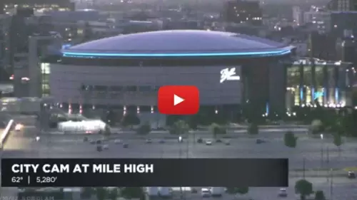
This high-vantage stadium infrastructure camera tracks real-time crowd dynamics, NFL turf conditioning, and rapid weather shifts at Mile High Stadium in Denver, Denver County, Colorado. Perched securely on an elevated tracking framework overlooking the massive playing field, it delivers round-the-clock visual feedback for event planners and sports fans monitoring facility gate lines, seating bowl saturation, and local visibility parameters past the stadium gates.
National Football Leagues, Light Rail Access Loops, and Denver Logistics
DENVER WEATHERServing as the iconic home of the Denver Broncos since its historic opening gates originally materialized in 1948, this massive sports colosseum handles an intensive daily multi-modal transit load. With an immense seating capacity that can host over 76,000 spectators, the stadium stands as one of the largest and loudest venues in the United States, celebrated globally for its raucous home-field advantage and historic playoff memories.
Because the stadium sits at a high altitude exactly a mile above sea level, the thin mountain air adds a grueling physical element for visiting teams while offering stunning, sweeping views of the Rocky Mountains to the west. Checking this continuous visual window simplifies tracking for local transport networks managing peak-hour vehicle parking lot saturation across the surrounding Sun Valley tailgating lots, lets game-day commuters audit transit queues near the Decatur-Federal light rail platforms, and coordinates public safety patrol loops.
If you are planning a football weekend or commuting through the central valley, this live page is excellent for checking local weather and snow accumulations before you travel. The ballpark sits at the absolute center of a thriving sports and entertainment district, directly interfacing with high-velocity avenue crossroads, regional bike paths, and expanding riverfront corridors. Visitors exploring the Mile High City can check the local radar on this page before catching a massive stadium summer concert or festival, touring the interactive museum exhibits downtown, walking the scenic paths along the nearby South Platte River, or routing travel assets toward the major highway corridors of Interstate 25 and Colfax Avenue.
- The Massive NFL Football Gridiron: Track real-time yard line painting, pre-game team warm-up configurations, concert stage staging alignments, and immediate turf weathering under the changing Colorado sun.
- The Main Entry Plazas and Tailgating Fields: Watch stadium visitor movement pacing, security screening turnaround speeds, gate queues, and local public safety vehicle safety clearances across the open-air parking lots.
- The Multi-Tiered 76,000-Seat Grandstands: Observe fan assembly configurations across the massive concrete bowl, checking gate processing speeds and upper-deck saturation levels before kick-off.
- The Windward Rocky Mountain Horizon: Evaluate changing valley radiation fog blankets, real-time daylight visibility depths over the rugged mountain peaks to the west, and spectacular high-country sunsets.
Logistics, Transit & Stadium Infrastructure Reference Grid
- Physical Anchor Site: Upper Structural Overlook Gantry, Stadium Operations Telemetry Tier, Main Seating Bowl Axis, Empower Field at Mile High, 1701 Bryant Street, Denver, Denver County, CO 80204
- Target Landmark Footprint: 76,000-Seat High-Capacity National Football League Stadiums, Sprawling Multi-Acre Tailgating and Parking Staging Fields, Connected Light Rail Track Networks at RTD Decatur-Federal Station, and Waterfront Corridors along the South Platte River
- Geographic Coordinates: 39.7439° N, 105.0201° W (Mile High Stadium Ballpark Center Centroid Baseline)
- Primary Automotive Axis: Bryant Street / Colfax Avenue / Federal Boulevard / 17th Avenue / National Interstate 25 Corridor (Main Front Range Freight Pipeline) / Fast Route to the central Denver International Airport (DEN) Freight Aviation Motorways
- Primary Mass Transit Access: Decatur-Federal Station Terminal (High-Traffic RTD Light Rail Tracking the W Line / Regional Game-Day Express Shuttle Bus Networks)
- Best Daily Viewing Times: 24/7 continuous stream. Game-day afternoon and evening slots capture intense high-frequency fan entry loops and vibrant stadium architectural light arrays under advanced low-light adjustments flawlessly, while crisp morning windows track daily stadium maintenance routines safely.
- Regional Transit Context: Positioned securely at the geographical core of the county commercial and transit tracking network, anchoring all sub-district crowd tracking, territory zone data logging, and emergency city evacuation monitoring infrastructure of the area.