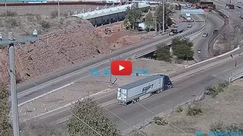
Monitoring the high-security transit arteries, customs staging areas, and commercial freight lanes of the South-Central border zone, this real-time visual viewport delivers an unbroken broadcast from the Garita Nogales checkpoint in Nogales, Sonora, Mexico. Positioned over the critical international boundary interfacing directly with the U.S. Customs and Border Protection Mariposa Port of Entry in Arizona, this weather-hardened lens mesh serves as an essential logistics, trade, and regional transit checkpoint.
Long-haul commercial truck dispatchers evaluate freight terminal road gridlock before authorizing shipping runs, daily cross-border commuters check automotive lane saturation velocities to minimize customs queuing delays, and motorists monitor real-time vehicle transit velocities and changing Sonoran Desert weather fronts.
Border Crossing Corridors, Inspection Plazas, and Cargo Logistics
NOGALES WEATHERThe high-angle perspective frames the multi-lane vehicle processing checkpoints and customs inspection gates where international commercial supply lines directly interface with cross-border highway networks. Shifting vehicle staging rows, pedestrian walkway footprint packing, and import-export lane congestion update continuously to take the guesswork out of mapping your international travel paths.
- The Garita Automotive Lanes: Watch real-time personal vehicle transit velocities, commuter queue formations, and peak-hour border bottleneck lanes.
- The Pedestrian Inspection Gates: Monitor cross-border pedestrian traffic densities, customs gate queue lines, and entry plaza clearance rates.
- The Commercial Freight Interchanges: Track commercial truck staging rows, cargo inspection lane velocity vectors, and transport hauler movements.
- The Sonoran Desert Sky Horizon: Evaluate incoming seasonal dust storm cells, rapid convective monsoon rain bands, and ambient daylight visibility depths over the valley terrain.
Logistics, Transit & Infrastructure Reference Grid
- Geographic Axis Anchor: Garita de Cruce Mariposa Complex, Nogales, Sonora, 84000, Mexico (Interfacing with Mariposa Port of Entry, Nogales, AZ 85621)
- Exact Map Coordinates: 31°19’53.2″N 110°58’11.5″W
- Primary Automotive Axis: Mexico Federal Highway 15 / Interstate 19 Corridor (Connecting Sonora straight to Arizona)
- Best Daily Viewing Times: Peak weekday morning slots (6:00 AM to 9:30 AM) and late afternoon windows (3:30 PM to 6:30 PM) for tracking maximum cross-border commuter transit queue data.
- Regional Transit Context: Situated securely across the international boundary line, anchoring the primary commercial trade pipeline between the state of Sonora and the Southwest United States, positioned miles west of the Dennis DeConcini Port of Entry, and serving as the focal multi-camera gantry for US-Mexico border road conditions.