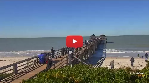
This elevated oceanfront camera tracks real-time beach conditions, Gulf of Mexico groundswell lines, and changing shoreline configurations from the coastal tier of Naples, Florida. Positioned along the high-density resort tier of the public beachfront, this weather-hardened observation gantry functions as a critical regional travel checkpoint, recreational small-craft safety sentinel, and Collier County coastal weather tracking station.
Offshore mariners, local parasail operators, and commercial charter captains cross-reference the live broadcast to evaluate nearshore wave lip geometries and tidal current speeds, while inbound travelers monitor street-level promenade crowd packaging and vehicle traffic variations near local resort access lanes.
Pure Quartz Strands, Pier Frameworks, and Gulf Shore Boulevard Logistics
NAPLES WEATHER
The high-angle infrastructure perspective delivers clear visual data covering the expansive public sand strands, sub-tropical dune borders, and coastal access paths where high-density seasonal tourism directly interfaces with the primary overland transportation networks of the Florida shoreline. Checking the live feed makes it simple for motorists, emergency response teams, and regional transport fleets to track changing weather patterns, evaluate immediate public pier lane saturation, and note longshore drift trends along the coast.
Verifying eyes-on conditions directly from this oceanfront camera container is an essential safety precaution because sudden low-pressure systems tracking off the open Gulf, intense summer tropical depression downpours, or seasonal hurricane paths can flood the low-lying coastal asphalt and alter regional driving safety instantly.
- The Main Naples Pier Framework: Monitor real-time pedestrian walking velocities, pierhead angler staging densities, and immediate wooden pile structural weathering parameters.
- The Public Beach Sand Strands: Track nearshore beachfront crowd packing rows, intertidal sandline exposure widths, and seasonal beachfront shell row accumulations along the water.
- The Adjacent Gulf Shore Boulevard Corridors: Watch street-level vehicular lane saturation, public beach parking lot staging queues, and adjacent commercial avenue traffic flow.
- The Deep-Water Gulf Marine Horizon: Evaluate incoming sub-tropical storm fronts, dense morning advection marine fog clearing timelines, and real-time daylight visibility depths over outer shipping tracks.
Logistics, Transit & Coastal Infrastructure Reference Grid
- Geographic Axis Anchor: Historic Naples Pier Terminal, 12th Avenue South (at Gulf Shore Boulevard), Naples, Collier County, FL 34102
- Exact Map Coordinates: 26°07’56.2″N 81°48’39.4″W
- Primary Automotive Axis: Gulf Shore Boulevard / 12th Avenue South / 9th Street South (U.S. 41 Pipeline Corridor) / Quick Connection to 5th Avenue South
- Primary Waterway Access: Naples Beachfront / Gordon Pass Small-Craft Access Channels / Gulf of Mexico Open Shipping Lanes
- Best Daily Viewing Times: Continuous 24/7 logging; morning drive slots for tracking high-contrast wave lips against horizontal sunrise lighting; late afternoon windows on summer weekends for tracking peak causeway traffic bottlenecks, checking outbound vehicle congestion loops, and monitoring public beach crowd dispersal logs.
- Regional Transit Context: Situated securely along the high-traffic southwestern coast of the barrier island network, anchoring the primary public parking, commercial trade, and local transit tracking infrastructure of the district, positioned miles north of central Marco Island logistics zones, west of downtown mainland networks, and serving as the focal gantry for regional coastal logistics.