Alouette Beach Webcam Resort – Old Orchard Beach – Live Video
October 4, 2023
Watch this live HD webcam from Alouette Beach Resort in Old Orchard Beach, Maine. Enjoy the seacoast and 7 miles of sandy beach coastline.
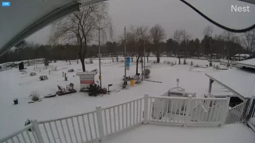
Old Orchard Beach Campground Live Webcam | Maine
October 24, 2021
Enjoy this Old Orchard Beach Campground Live Webcam. This HD live cam takes you to a road gate at this campground in Old Orchard Beach, Maine.

Abellona Inn & Suites Live Cam – Old Orchard Beach, Maine
October 22, 2020
Abellona Inn & Suites is located directly on the surfside section of Old Orchard Beach, Maine.

Old Orchard Beach Live Cam – Maine – HD Video
October 12, 2020
Old Orchard Beach Surfline Cam, check the weather conditions, and see what’s happening before you go.
Live Old Orchard Beach Webcam
Watch all live HD webcams from around Old Orchard Beach, Maine. The live camera at Old Orchard Beach offers a captivating view of one of Maine’s most popular coastal destinations. This webcam provides real-time footage of the beach, showcasing the stunning sandy shores, vibrant boardwalk, and the picturesque Atlantic Ocean.
Visitors and locals alike can enjoy the dynamic scenery, whether it’s the sun-drenched days of summer or the tranquil beauty of off-season months. The webcam serves as a virtual window to the beach, allowing viewers to experience the atmosphere and activities taking place in this charming seaside town.
The boardwalk, lined with shops, restaurants, and amusement rides, adds to the vibrant ambiance. Moreover, it allows potential visitors to check the weather conditions, beach crowd levels, and overall vibe before making their trip.
Equipped with a beachside amusement park, boardwalk, and iconic 500-foot-long pier, Old Orchard Beach has a small-town “Coney Island” feel. Many visitors praise the town for its walkability. Old Orchard Beach is just 13 minutes away from Scarborough. The town is located in York County and has a population of nearly 9,000 residents.
There are perfectly placed beachfront hotels along the boardwalk, providing ideal access to the boardwalk, ocean, and pier. Old Orchard Beach Campground is conveniently located only 1 mile from the beach, it’s a nice central location in relation to proximity to restaurants and things to do. View the map of Old Orchard beach below and check out the 7-day weather forecast above.
York Maine Cams: Union Bluff : Short Sands Beach
Scarborough Maine Cams: Higgins Beach : Scarborough Beach
Explore this stunning coast at OOB
One of the main attractions is the mile-long sandy beach, which offers ample space for sunbathing, swimming, and beach games. Families flock to the beach to enjoy building sandcastles or taking leisurely strolls along the shoreline. In addition to its natural beauty, the beach features various amenities, including concessions, restrooms, and showers, making it easy for visitors to spend a whole day enjoying the sun and surf.
Another highlight of Old Orchard Beach is the iconic Palace Playland amusement park, located right by the beach. Open since 1902, this amusement park is home to exciting rides and games for all ages. Families can experience thrilling roller coasters, funhouses, and a giant Ferris wheel that provides stunning views of the beach and the surrounding area. The park also offers various arcade games and traditional carnival foods like cotton candy and popcorn, making it a perfect spot for a fun family outing during your visit.
As the sun sets, Old Orchard Beach transforms into a lively hub of entertainment. The famous Old Orchard Beach Pier is a must-see, where visitors can enjoy fishing or simply taking in the beautiful ocean views. The pier also hosts various restaurants and shops, giving tourists a taste of local cuisine and culture. In the evenings, the area offers live music, beach bonfires, and special events, making it a vibrant place to unwind and enjoy the seaside atmosphere after a full day of activities.