This centralized multi-camera directory coordinates real-time visual surveillance networks across Times Square in Manhattan, New York. It bridges high-density automotive corridors, municipal mass transit station lines, and massive commercial media networks into a single operational interface. Engineered for regional transit planners, commercial freight dispatchers, metropolitan emergency response teams, and civil security grids, this localized index tracks changing weather patterns, multi-lane avenue lane saturation, and pedestrian plaza bottleneck distributions past the core Midtown trading tier.


Commercial Thoroughfares, Mass Transit Corridors, and New York County Logistics
MANHATTAN WEATHERThis central tracking matrix acts as a crucial public safety tool, charting environmental changes and road surface saturation profiles across the core Broadway and 7th Avenue corridors. Logistics fleets, local delivery services, and commuters utilize these combined live feeds to monitor sudden weather fronts tracking over the Hudson River, evaluate rush-hour gridlock backups leading toward the Lincoln Tunnel approaches, and cross-reference real-time lane clearance parameters before routing heavy commercial transport assets or deploying emergency response personnel through the metropolitan center.
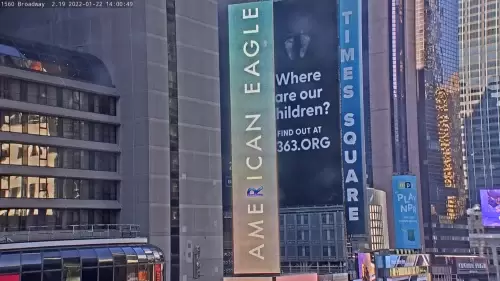
- The 7th Avenue Arterial Transit Lanes: Watch real-time multi-lane vehicle velocities, public transit bus lane queues, and daily commercial delivery freight rows.
- The Broadway Commercial Intersection Blocks: Track street-level vehicular lane saturation, adjacent taxi staging queues, and local delivery vehicle loading zone clearances.
- The Duffy Square Pedestrian Staging Promenades: Monitor mass transit subway station entrance queues, civic assembly packaging densities, and immediate streetscape asset weathering.
- The Nasdaq Tower Media Horizon: Evaluate high-altitude visibility deep between the skyscraper corridors, low-lying cloud ceilings, and real-time daylight clarity variables.
Logistics, Transit & Urban Infrastructure Reference Grid
- Geographic Axis Anchor: Central Times Square Concourse, Broadway (at 7th Avenue), New York City, New York County, NY 10036
- Exact Map Coordinates: 40°45’24.5″N 73°59’11.5″W
- Primary Automotive Axis: Broadway Pipeline Corridor / 7th Avenue / 42nd Street / 47th Street / Quick Connection to the Lincoln Tunnel and I-495 Logistics Expressways
- Primary Sub-Surface Axis: MTA New York City Subway Network (Times Square–42nd Street / Port Authority Bus Terminal Hubs)
- Best Daily Viewing Times: Continuous 24/7 logging; peak morning rush-hour windows (7:30 AM to 9:30 AM) for checking overnight weather accumulation parameters; late afternoon transit frames (4:00 PM to 6:30 PM) EST for auditing midtown traffic bottlenecks and tracking cross-island weather front velocities.
- Regional Transit Context: Situated securely at the absolute heart of the central Manhattan trade and transit tier, anchoring the single largest municipal transport coordination hub, international media broadcast network, and regional highway transport tracking infrastructure of the district.