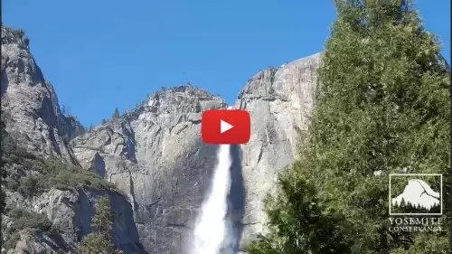
This multi-camera directory hub delivers a centralized network grid mapping the sheer granite monoliths, glacial valley meadows, and alpine transit corridors of Yosemite National Park, California. Operating as a practical visual index, this collection helps high-altitude rock climbers evaluate immediate wind shear vectors along the vertical faces of El Capitan, backcountry hikers audit mountain trail snowpack depths beneath Half Dome, and regional travelers monitor real-time Sierra Nevada weather systems, seasonal wildfire smoke density, and valley floor road congestion before entering the park gates.
Granite Monolith Topography, Waterfall Logistics, and Backcountry Conditions
The centralized streaming index provides wilderness backpackers, search and rescue teams, and international tourists immediate access to eyes-on data to eliminate high-altitude travel guesswork. Because severe alpine weather fronts can slam across the Sierra Crest instantly—dropping heavy winter blizzard snowpack, bringing sudden lightning hazards to exposed ridges, or cloaking the valley floor in dense mountain fog—verifying clear horizon lines and visibility ceilings beforehand is a critical safety precaution.
- The Yosemite Valley Floor Meadows: Watch real-time pedestrian boardwalk foot traffic density, seasonal meadow flooding, and road lane congestion across the valley floor.
- The El Capitan Granite Monolith: Monitor real-time daylight visibility depth, localized storm tracks striking the 3,000-foot rock face, and mountain climbing routes.
- The Half Dome Crest Trails: Check alpine cloud ceilings, winter snowpack accumulation timelines, and structural cable path conditions for advanced hikers.
- The Upper & Lower Yosemite Falls: Track seasonal watershed volumes, springtime snowmelt flow rates, and waterfall mist clearing lines.
Alpine Protected Topography and Mariposa County Transit Info
The weather-hardened camera network utilizes elevated national park ranger structures, valley floor monitoring gantries, and high-vantage wilderness outposts to track environmental safety across the 759,000-acre UNESCO World Heritage site.
- Exact Valley Center Coordinates: 37°44’44.2″N 119°31’59.5″W
- Primary Automotive Axis: Southside Drive / Northside Drive Loop (Yosemite Valley Corridor)
- Geographic Base Anchor: Yosemite Valley Visitor Center, 9035 Village Dr, Yosemite National Park, Mariposa County, CA 95389
- Regional Transit Lines: Situated deep within the Sierra Nevada mountain range, positioned directly off State Route 41 (Wawona Road) and State Route 140 (El Portal Road), minutes north of the ancient sequoia groves at Mariposa Grove, and extending east toward the high-altitude passes at Tuolumne Meadows.
Practical Logistical Inquiries for Sierra Nevada Travelers
When are the best daily times to monitor the Yosemite valley camera feeds?
Tuning into the live camera matrix during the early morning hours provides the absolute clearest horizontal lighting for identifying granite cliff textures and checking morning mountain mist clearing timelines over the valley floor. Checking the feeds during the spring months (May and June) offers the best look at peak waterfall flow velocities, while winter check-ins are ideal for tracking active snowpack and vehicle tire chain requirements along the mountain roads.
Can you view the interior museum galleries or historic guest rooms of The Ahwahnee hotel from these lenses?
No. To maintain strict public privacy frameworks and wilderness public safety tracking utility, the camera network keeps its frames locked entirely onto the exterior granite monoliths, open valley meadows, and public trail corridors. The indoor dining rooms, historic stone fireplace lounges, and private guest suites of the historic hotel properties are situated deep within the forest tree lines, placing them completely out of range of these lenses.
Do drivers need a specialized permit reservation to navigate the valley roads shown on screen?
Yes. During peak summer holiday weekends and high-congestion seasonal travel windows, the National Park Service frequently implements temporary vehicle reservation and peak-hours pass systems to limit gridlock along Southside Drive and Northside Drive. Reviewing the live high-angle traffic streams helps motorists and day-trippers gauge general valley meadow density and parking lot saturation before approaching the ranger entrance gates.